
By Joseph Rogers
To close out transit month, and to celebrate a beautiful fall in the Bay Area, Transbay Coalition would like to highlight some great options to get outdoors without a car!
There are already some great resources out there to plan your trip. If you’re looking for a bike ride, BARTable (bartable.bart.gov/outdoors) has a long list of great rides you can access by train! On the other hand, if you’re looking to get closer to nature and go for a hike, the website hikingbytransit.com is a fantastic resource to plan your next adventure.
Transbay Coalition members spent a lot of time outdoors via transit, including some of the routes publicized above! Here’s a review of how they went, that you can hopefully find inspiration from for your own outdoor-by-transit adventure!
Sawyer Camp Trail from Milbrae BART
BARTable trip guide: https://bartable.bart.gov/featured/bartable-bike-sawyer-camp-trail
This route winds up some steel hills from the Millbrae BART Station, but then drops riders on a glorious stretch of paved path that runs through the woods along the equally-picturesque San Andreas Lake and Crystal Springs Reservoir. Note that access is easy from both BART and Caltrain, which makes this route accessible to anyone within biking distance of either network! The author did this ride on a hot day, and found the trail a bustling respite from the hot September sun. The route unfortunately begins by crossing El Camino Real at a busy, car-oriented intersection, but once you cross it safely (I recommend walking your bike in the crosswalk), the route follows a more local road which had minimal car traffic on a weekend morning. Once you get up to the ridge, you can actually follow the trail in either direction – though note that the trail to the northeast is less-smoothly paved and shorter. See the BARTable trip guide, linked above, for more information on how to access this fun route!
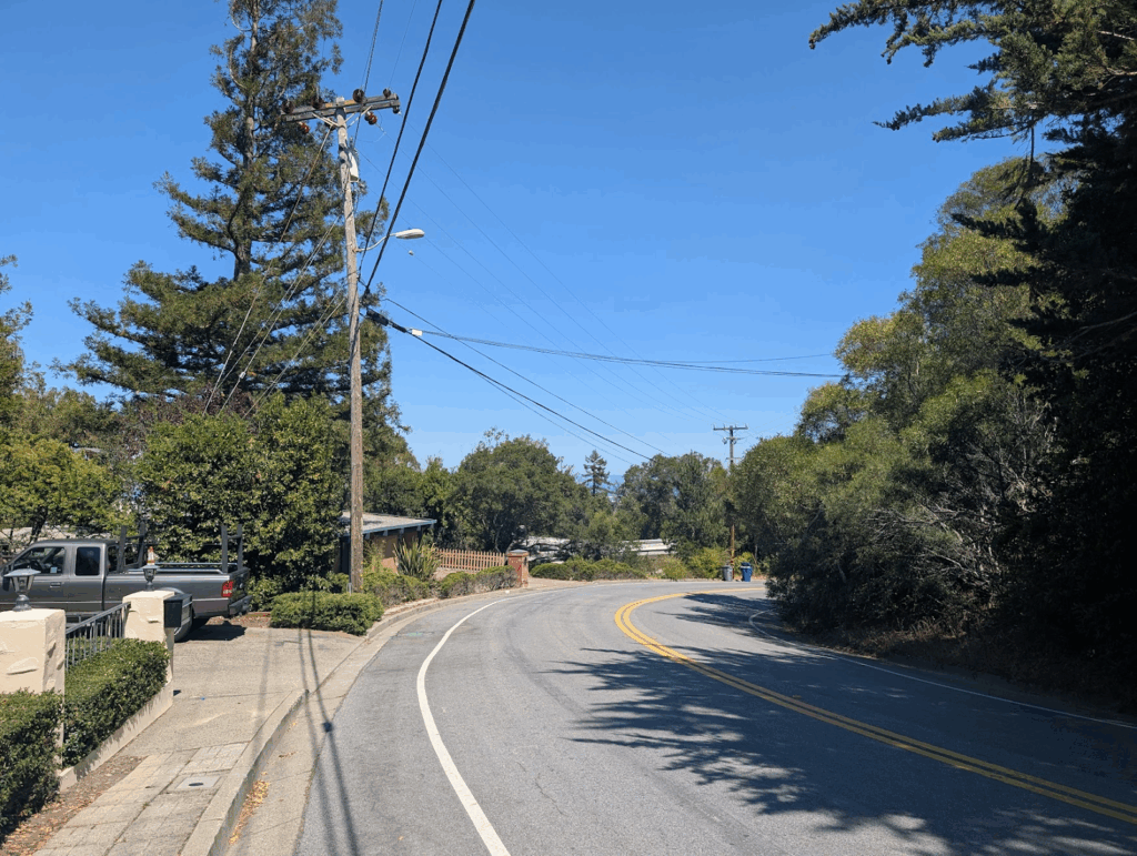
Looking back down the hill up from Millbrae!
Turn-around point at Sawyer Camp South Trailhead
Viva Calle & Guadeloupe River, San Jose
Viva Calle information: https://www.vivacallesj.org/
Viva Calle is a fun event in San Jose which closes streets to traffic in favor of people walking and biking! There are many ways to access this event (see the link above for future dates and routes), but our correspondent took the bus to Diridon Station and continued towards the Guadeloupe River on foot. Events such as Vive Calle are a great opportunity for more of an urban hike to explore what makes our cities such great places to be! As a bonus, the Guadeloupe River runs through San Jose, and is accessible from this route, adding a concentrated dose of nature to the experience. Bay Area residents from all over San Jose should check this event out the next time it runs, as should anyone on the Peninsula who can take Caltrain down to Diridon!
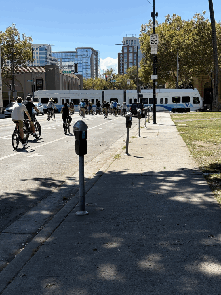
Bikers stop for a VTA Light Rail during Viva Calle in September, 2025
A view of the Guadeloupe River from the route
Ocean Beach by Bike!
BARTable trip guide: https://bartable.bart.gov/featured/bartable-bike-ocean-beach
Last November, San Francisco residents voted to make Ocean Highway into a 24/7 park, now known by the name Sunset Dunes! The former road is a great biking route, and the journey to get there from BART is even more scenic. Follow the BARTable guide above to wind through Golden Gate Park down to the ocean, where you can coast along the largely-flat former highway among other bikes and walkers. This is a classic ride, and anyone with a bike in the area should give it a try! Note that the beach is often cloudy and can be colder than much of the region (and it indeed was when we headed out there), so check the weather before heading out and dress accordingly. This route also gives you a chance to stop in iconic San Francisco neighborhoods such as the Haight and Nopa, and if you get too cold biking by the surf, these tend to be sunnier than the beach.
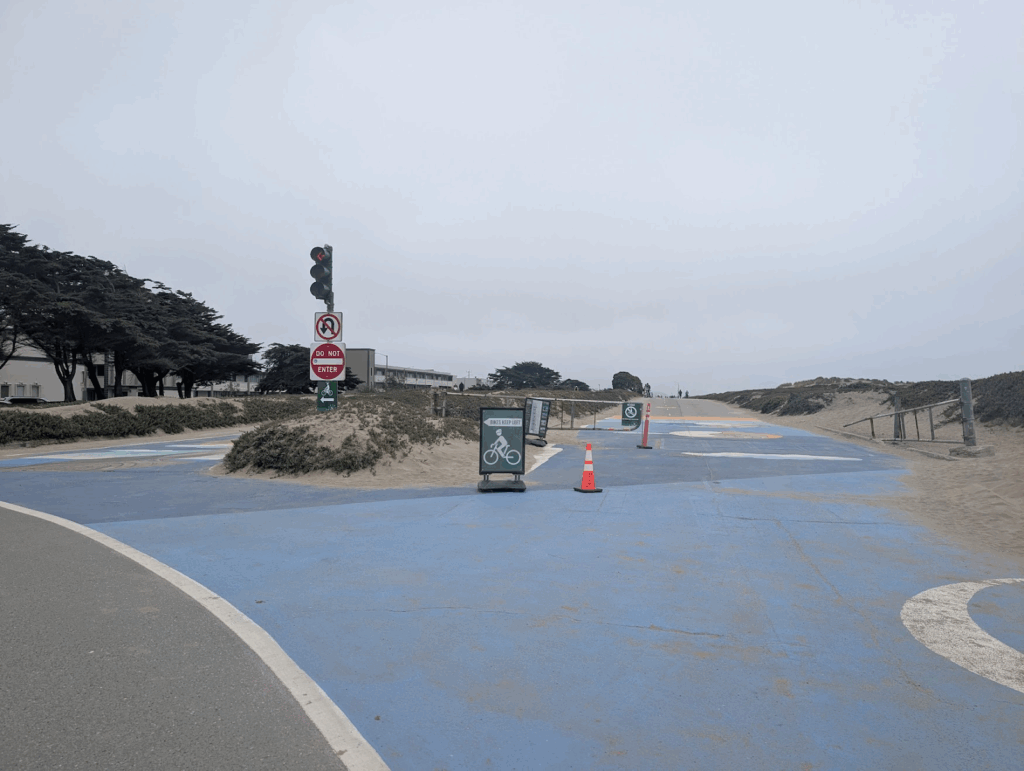
Bikes are encouraged to keep to the eastern half of the former Great Highway, though there are plenty of bike racks if you want to park and dip your toes in the water!
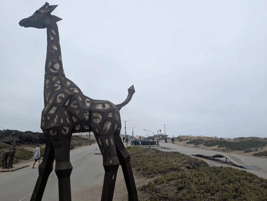
The new park name has been accompanied by new features such as sculptures and a mini skate park at the very end of the route!
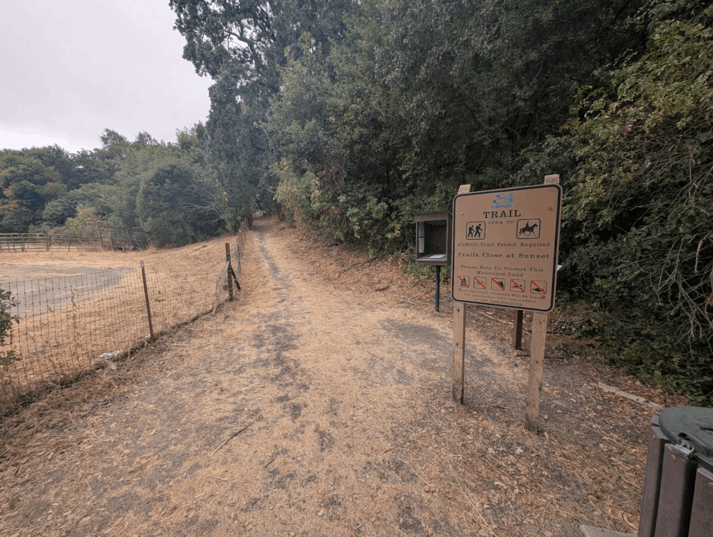
Siesta Valley Hike from Orinda BART
Hiking by Transit guide: https://hikingbytransit.com/hikes/siesta-valley/
EMBUD Permit: https://www.ebmud.com/recreation/550 ($3 at time of writing, you want the EB Watershed option)
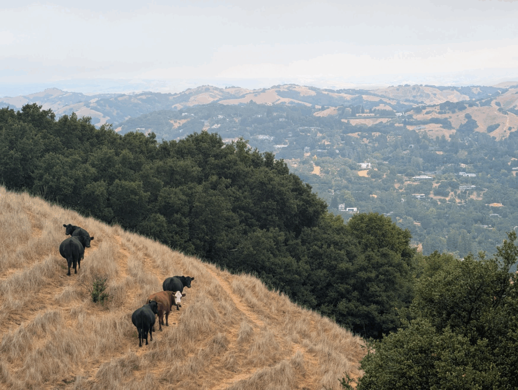
The Siesta Valley is tucked away in plain sight in the East Bay Hills. Located between Berkeley and Orinda, the hiking trails through the valley not only pass through beautiful natural environs, but are also typically quiet because of the lack of parking on the Orinda side and the requirement to get an EBMUD permit to use the space. However, the permit is only a few dollars, and the trailhead is relatively close to the Orinda BART Station, which makes this route a boon for transit-using bay area hikers! When the author hiked this trail, it was one of those chilly fall mornings which rewards hikers with ethereal views of clouds passing amongst the trees. However, on clear days, you will be further rewarded with views across the entire bay including the SF Skyline and both the Bay and Golden Gate bridges!
The author and the Hiking by Transit guide both started in Orinda, but this trail gives you many options – it connects to the whole network of trails in Tilden Regional Park above Berkeley, and those in turn connect you all across the spine of the East Bay Hills. One of the advantages of hiking without a car is that you have no need to end where you start, and the shown route takes full advantage by dropping hikers at Berkeley BART to complete the trip! Note that the start of the hike in Orinda requires crossing Camino Pablo, which is best done at Santa Maria Way. This can be tricky as there is no intersection, but you can wait until Santa Maria Way has a green light and then cross with the parallel traffic.
The beginning of the hike
Watch out for other hiking groups!
So leave the car behind, go out and explore some of the beauty of the Bay Area via transit.
Happy Trails.